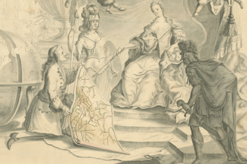
In the second half of the eighteenth century, military engineers mapped in detail for the first time the provinces and borders of the Habsburg Monarchy. Armed with plane tables and their own trained bodies, the engineers travelled on-site to perform the data collection required for the production of what officers, civilian bureaucrats and statesmen considered more accurate maps. The results of these impressive cartographic ventures provided the Viennese rulers with an essential component in the process of state defense and centralization and also contributed to the rise of mapmaking as a scientific discipline. Indeed, in addition to working in a provincial and imperial context, Habsburg military engineers constituted nodal points in knowledge-producing global networks. My presentation will examine the cartographic activity of military engineers in the Habsburg border provinces of Transylvania, the Austrian Netherlands and Lombardy, in order to reveal the active role of these imperial agents in refashioning both the Habsburg Monarchy and mapmaking in the Age of Enlightenment.
Madalina Veres is a historian of cartography and the Habsburg Monarchy with broader interests in the history of empires and science. She is currently working on her book manuscript entitled “Constructing Imperial Spaces: Habsburg Cartography in the Age of Enlightenment” based on her PhD dissertation defended at the University of Pittsburgh in 2015. Madalina’s work has appeared in journals, such as the Austrian History Yearbook and Itinerario, International Journal on the History of European Expansion and Global Interaction, and in collective volumes dedicated to the history of cartography.